Research
Northern Wildlife & Ecosystems
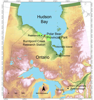
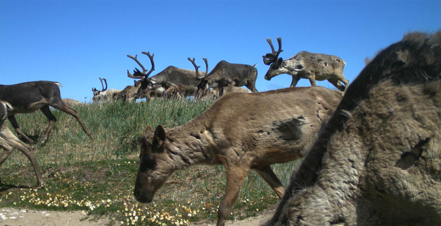
Hudson Bay Lowlands
Our team seeks to improve understanding of the functioning of sub-arctic ecosystems and anthropogenic impacts to northern biodiversity. We conduct field studies at sites along the southern coast of Hudson Bay, within Polar Bear Provincial Park, Ontario and near Churchill, Manitoba. The cold, maritime climate of Hudson Bay has a substantial cooling effect on the adjacent in-land terrestrial environment, creating unique sub-arctic conditions further south than at similar latitudes elsewhere in Canada. Many arctic adapted species occur here, such as shorebirds (e.g. dunlin, whimbrel), lesser snow geese, the artic fox and polar bears. For some species, the southern coast of Hudson Bay and James Bay represents the southern limit of breeding range. Inland from the coast, the Hudson Bay Lowlands extends between Ontario and Manitoba and is a globally significant wetland system, providing important breeding habitat for migratory birds. Climate warming and subsequent melting of permafrost in this region could change wetland hydrology, affecting plant and animal communities.
We study a range of ecosystem processes at multiple trophic levels to assess the resilience and vulnerability of this sub-arctic ecosystem, including shorebird and waterfowl breeding ecology, predator-prey interactions, arctic fox ecology, the effect of permafrost and wetland conditions on habitat, and how climate shapes community dynamics. Ultimately, we seek to integrate a range of information at multiple trophic levels and spatial scales to assess system dynamics and contribute knowledge to inform land use planning, conservation and sustainable resource management.
|
|
Shorebirds
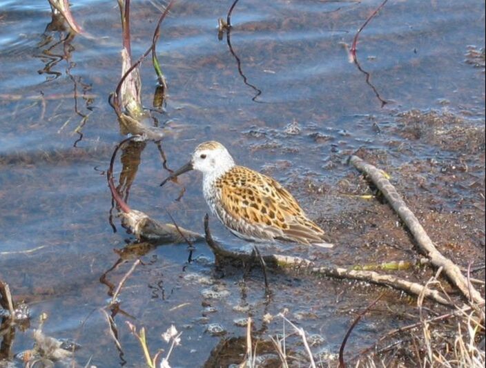
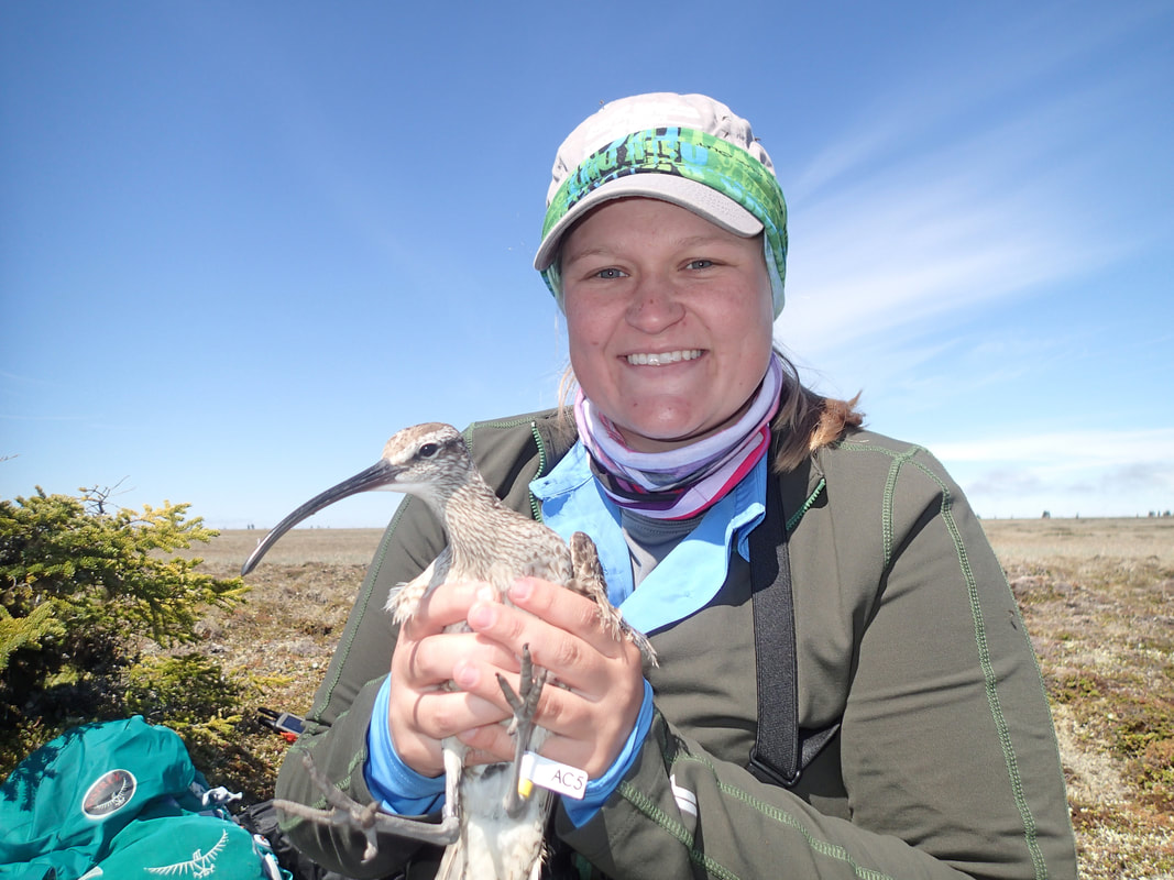
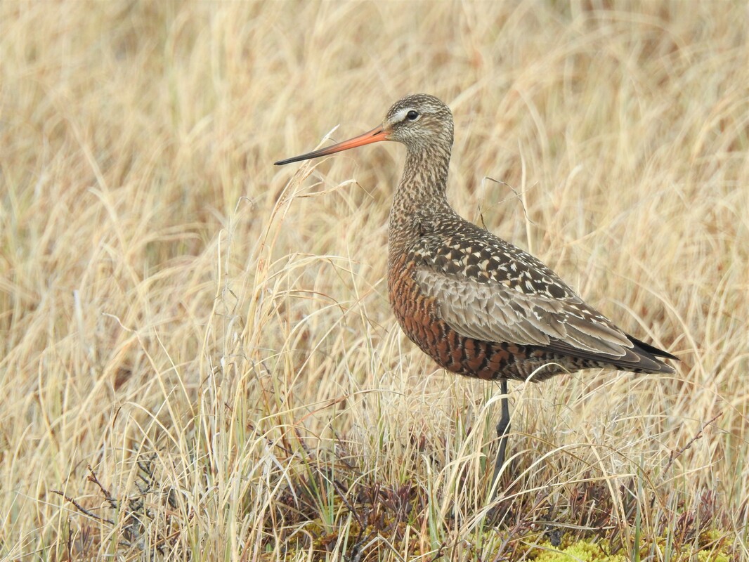
Several shorebird populations appear to be declining in North America but there is limited understanding of causes. We are studying shorebird nesting ecology, habitat-climate interactions, shorebird migration, and the importance of coastal areas of Hudson Bay as breeding and stopover sites. We use telemetry to track fine scale movements, habitat selection, and migration patterns of species such as whimbrel, Hudsonian godwit, dunlin, and least sandpiper. Study sites are located at Burntpoint Creek in Polar Provincial Park, Ontario and near Churchill, Manitoba. Partners in this work include Trent University (Dr. Erica Nol Lab), Environment and Climate Change Canada, Bird Studies Canada, and we are part of the Arctic Shorebird Demographics Network. In collaboration with the Interactions Working Group, involving a network of circumpolar arctic researchers, we are investigating how species interactions shape the arctic terrestrial wildlife community, with particular interest in how rodent population dynamics and food subsidies affect predation on shorebirds.
Several shorebird populations appear to be declining in North America but there is limited understanding of causes. We are studying shorebird nesting ecology, habitat-climate interactions, shorebird migration, and the importance of coastal areas of Hudson Bay as breeding and stopover sites. We use telemetry to track fine scale movements, habitat selection, and migration patterns of species such as whimbrel, Hudsonian godwit, dunlin, and least sandpiper. Study sites are located at Burntpoint Creek in Polar Provincial Park, Ontario and near Churchill, Manitoba. Partners in this work include Trent University (Dr. Erica Nol Lab), Environment and Climate Change Canada, Bird Studies Canada, and we are part of the Arctic Shorebird Demographics Network. In collaboration with the Interactions Working Group, involving a network of circumpolar arctic researchers, we are investigating how species interactions shape the arctic terrestrial wildlife community, with particular interest in how rodent population dynamics and food subsidies affect predation on shorebirds.
|
|
|
Arctic fox
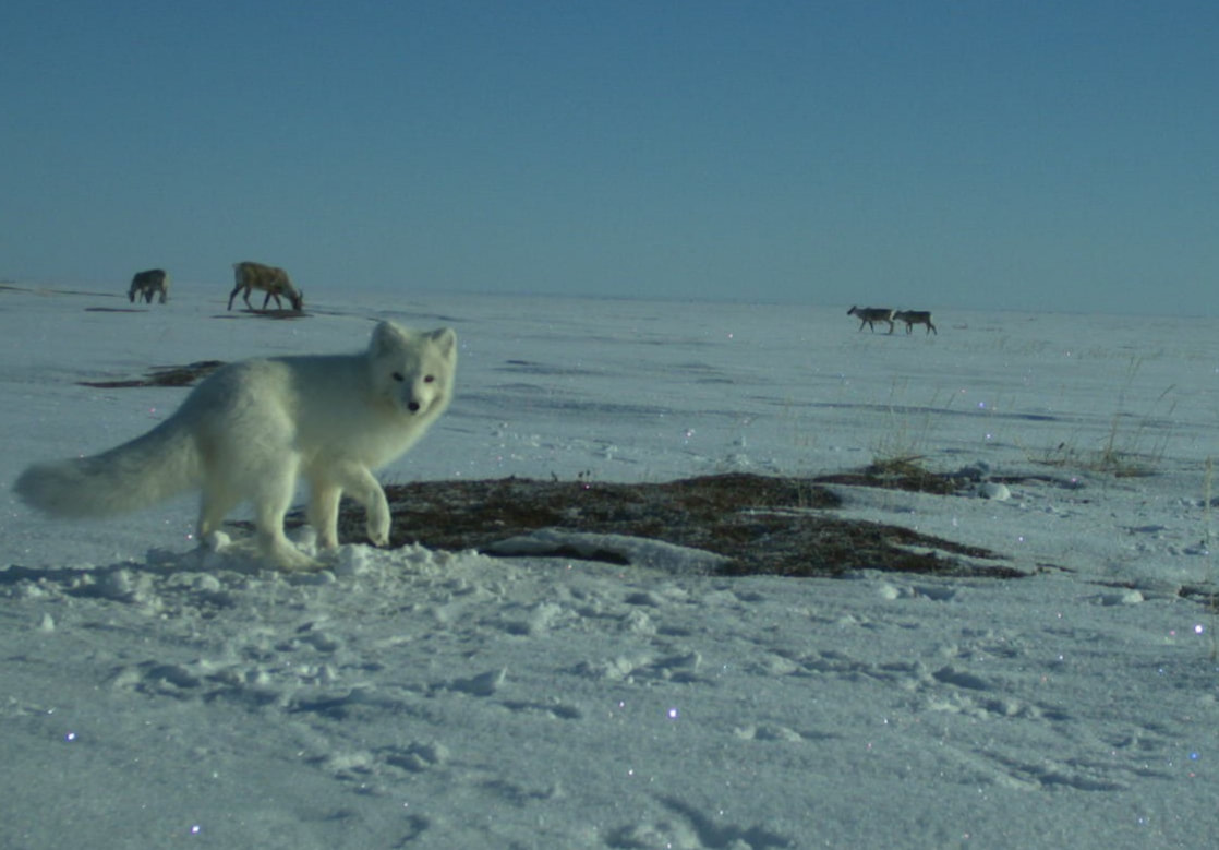
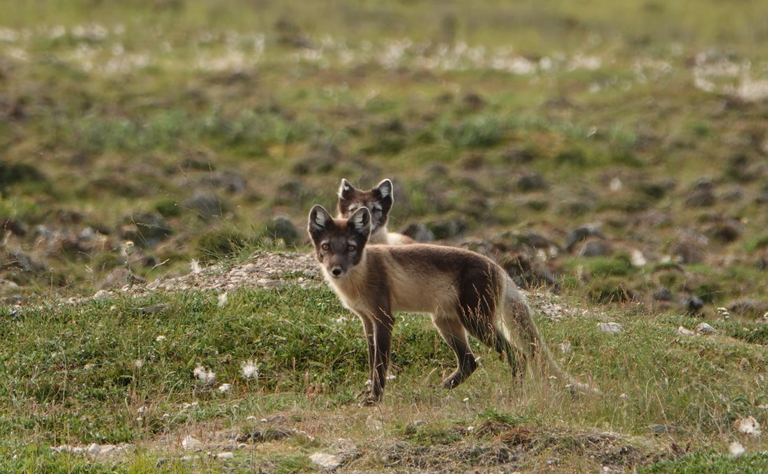
In Ontario, the arctic fox is limited to the far north of the province, near Hudson Bay and James Bay, representing the southern range limit in Canada for this circumpolar species. Little is known about the ecology of arctic fox in Ontario or its sensitivity to climate change, which has the potential to impact availability of resources, species interactions, and northward shifts in species distributions. Arctic fox den in raised sandy areas and dens are often used for many years. It is not known whether the availability of suitable denning habitat limits arctic fox populations in Ontario, or how sensitive denning sites may be to permafrost degradation induced by climate warming. The range of red fox has expanded into the Arctic during the past century and southern Hudson Bay is an area of overlap of both species. We are investigating the movements, habitat use and reproductive success of foxes using den surveys, remote cameras and GPS telemetry. Information is being used to assess evidence of competition among fox species, the vulnerability of arctic fox to climate change, and to support broader studies of trophic interactions and ecosystem resilience in the Hudson Bay Lowlands.
In Ontario, the arctic fox is limited to the far north of the province, near Hudson Bay and James Bay, representing the southern range limit in Canada for this circumpolar species. Little is known about the ecology of arctic fox in Ontario or its sensitivity to climate change, which has the potential to impact availability of resources, species interactions, and northward shifts in species distributions. Arctic fox den in raised sandy areas and dens are often used for many years. It is not known whether the availability of suitable denning habitat limits arctic fox populations in Ontario, or how sensitive denning sites may be to permafrost degradation induced by climate warming. The range of red fox has expanded into the Arctic during the past century and southern Hudson Bay is an area of overlap of both species. We are investigating the movements, habitat use and reproductive success of foxes using den surveys, remote cameras and GPS telemetry. Information is being used to assess evidence of competition among fox species, the vulnerability of arctic fox to climate change, and to support broader studies of trophic interactions and ecosystem resilience in the Hudson Bay Lowlands.
|
|
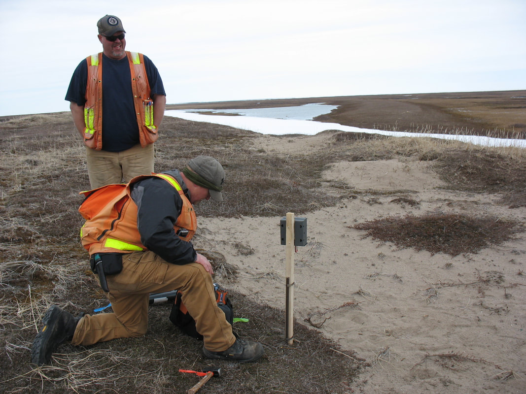
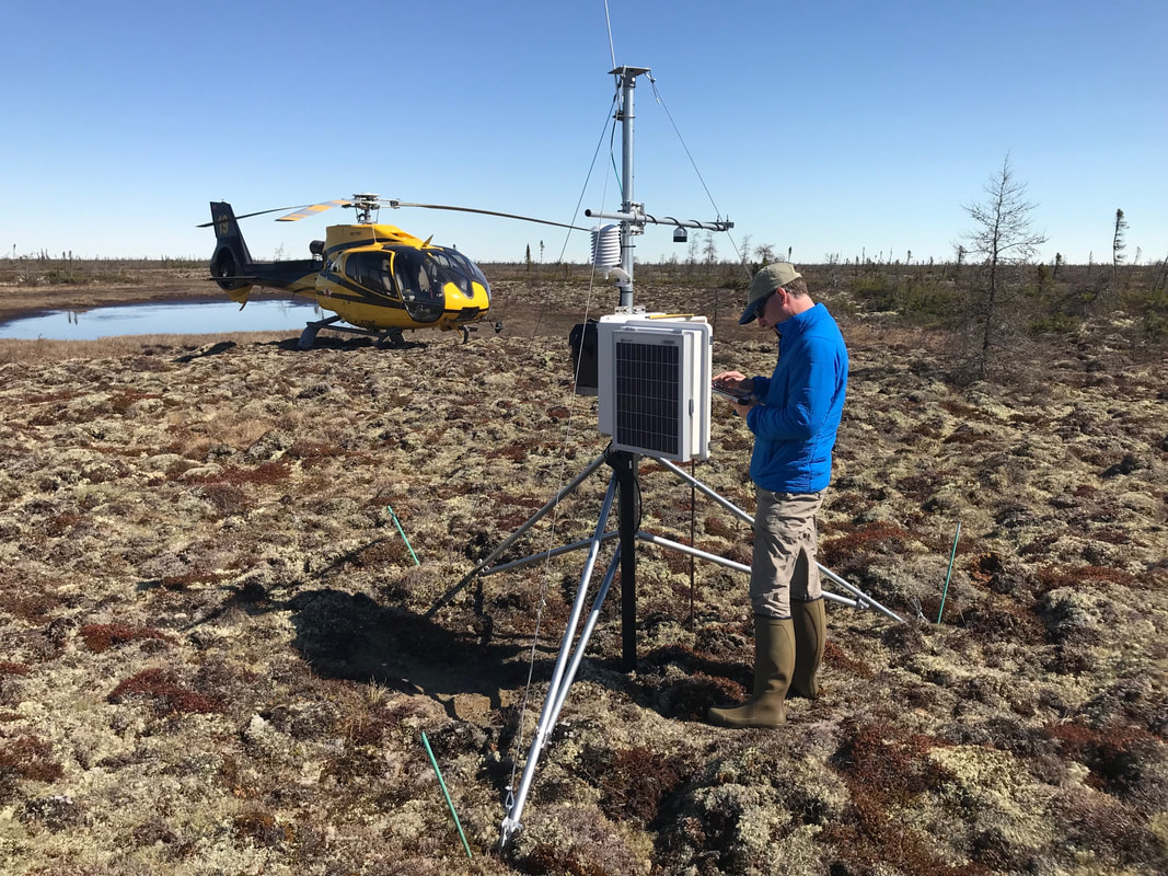
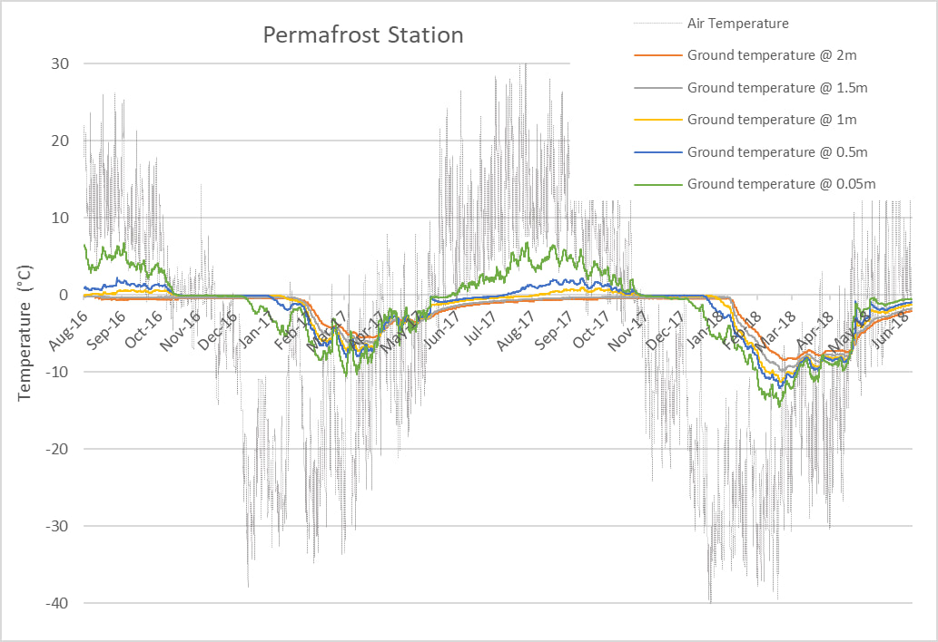
Permafrost
We monitor ground ice processes in the Hudson Bay Lowlands using manual and automated measurements of active layer depth. Our network of automated weather stations record ground and air temperature, precipitation and snow depth. Through collaborations with York University (Dr. Baoxin Hu) and grants from the Canadian Space Agency and Natural Sciences and Engineering Research Council we are developing InSAR techniques to characterize the relationship between terrain deformation and active layer thickness. The combined data provides long-term ground-based monitoring of active layer conditions and allows us to develop remote sensing tools for mapping change in permafrost and wildlife habitat across the Hudson Bay Lowlands.
We monitor ground ice processes in the Hudson Bay Lowlands using manual and automated measurements of active layer depth. Our network of automated weather stations record ground and air temperature, precipitation and snow depth. Through collaborations with York University (Dr. Baoxin Hu) and grants from the Canadian Space Agency and Natural Sciences and Engineering Research Council we are developing InSAR techniques to characterize the relationship between terrain deformation and active layer thickness. The combined data provides long-term ground-based monitoring of active layer conditions and allows us to develop remote sensing tools for mapping change in permafrost and wildlife habitat across the Hudson Bay Lowlands.
|
|
|
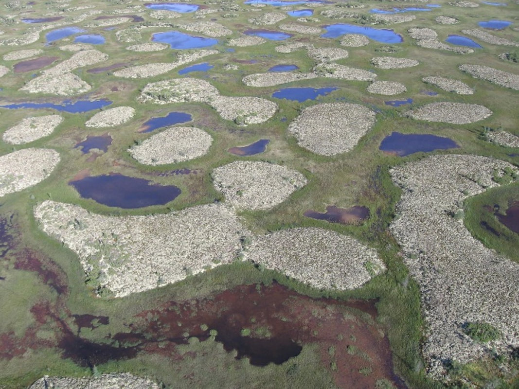
Remote Sensing and Habitat Mapping
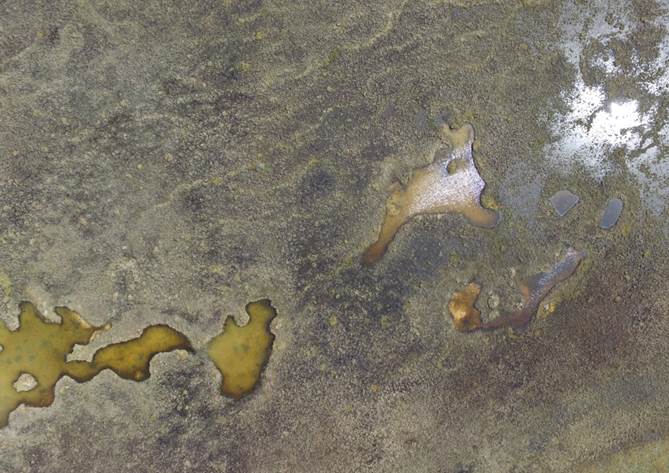
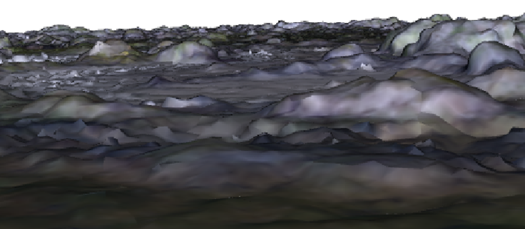
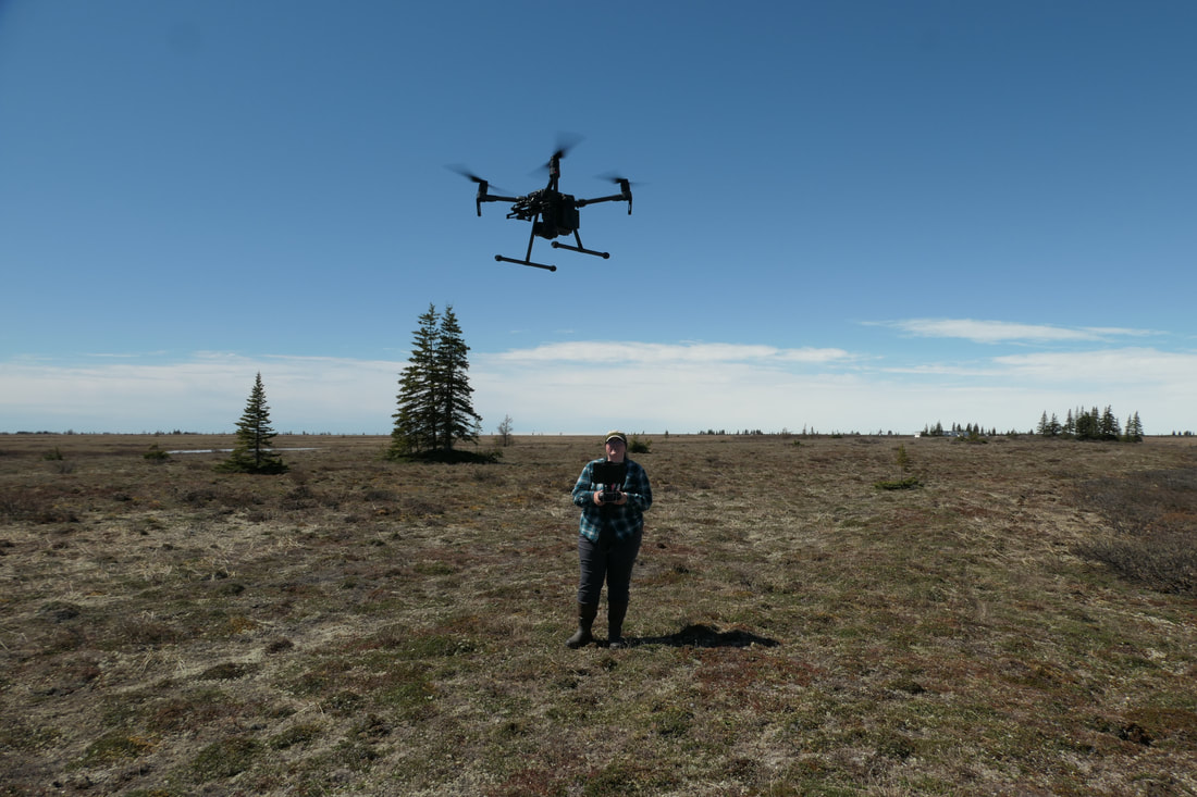
We use remote sensing (e.g. InSAR, optical, multispectral) to map fine scale features at large special extents and temporally repeated data products that can be used to characterise wetland habitat features (surface water, flooded vegetation, permafrost), assess wildlife habitat relationships, and response to change in this system. We also develop drone-based approaches to map fine scale habitat features and their spatial and temporal variability in the study area (e.g. surface water; hummock habitat and vertical vegetation structure relevant to breeding birds). These remote sensing products are used to assess habitat selection patterns of wildlife and the relationship between climate and habitat availability.
We use remote sensing (e.g. InSAR, optical, multispectral) to map fine scale features at large special extents and temporally repeated data products that can be used to characterise wetland habitat features (surface water, flooded vegetation, permafrost), assess wildlife habitat relationships, and response to change in this system. We also develop drone-based approaches to map fine scale habitat features and their spatial and temporal variability in the study area (e.g. surface water; hummock habitat and vertical vegetation structure relevant to breeding birds). These remote sensing products are used to assess habitat selection patterns of wildlife and the relationship between climate and habitat availability.
|
|
|
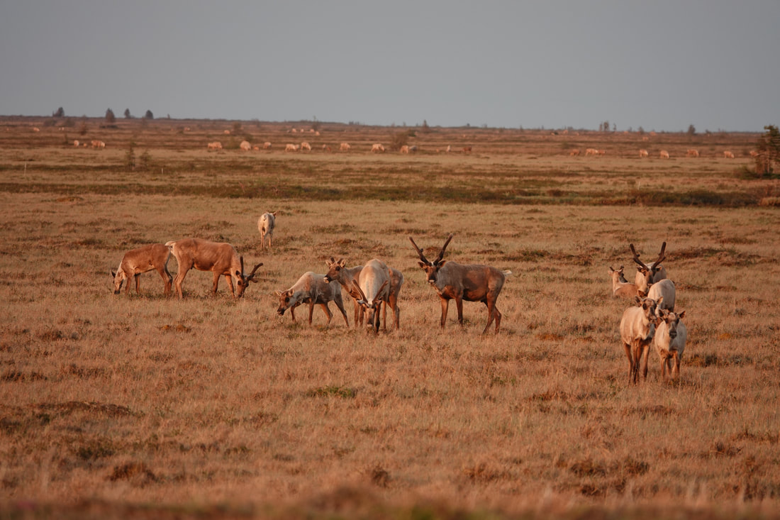
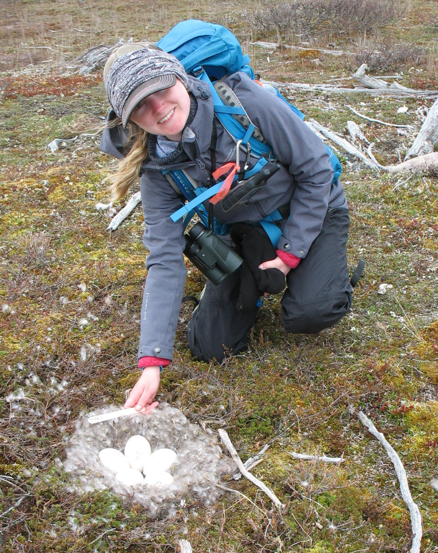
Waterfowl
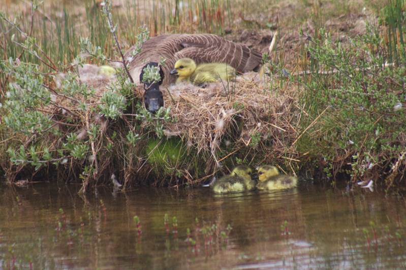
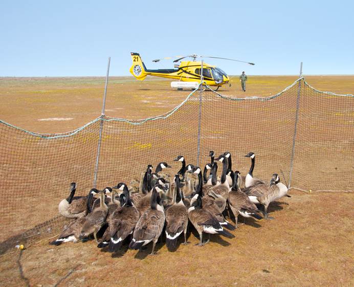
We continue a long-term study of Canada goose nesting ecology at our Burntpoint Creek Research Station, that includes annual monitoring of nest success, seasonal nesting phenology, and monitoring the status and trends of mid-continent populations that breed along the southern Hudson Bay coast (through aerial surveys and banding). A key driver of this work is to inform sustainable harvest of managed populations, through collaboration with the Mississippi Flyway Council, United States Fish and Wildlife Service, and Canadian Wildlife Service. We also use the long-term data to investigate drivers of population vital rates for this age structured population.
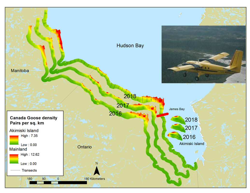
The mid-continent population of lesser snow geese increased substantially since the 1960s, largely in response to agricultural food subsidies. Despite control measures, snow geese remain overabundant and continue to damage breeding range habitat in the Canadian Arctic and at breeding colonies near Hudson Bay. The extent of impacts to geese and the broader ecosystem is still poorly understood and climate change may have additive cumulative effects. Through partnerships with the Hudson Bay Project, the Arctic Goose Joint Venture and Canadian Wildlife Service, we are investigating the impacts on wetland habitats, snow geese population dynamics and other species. We have study sites at the most southerly breeding colonies of snow geese in North America, including at Pérouse Bay, Manitoba (work led by Robert Rockwell, American Museum of Natural History), Cape Henrietta Maria, Ontario and Akimiski Island, Nunavut. Our combined study sites capture important contrasts in climate and alternate habitat availability. Ongoing work includes monitoring long term trends in snow geese (abundance and nest density) and their impact on habitat and other species, and development of efficient monitoring methods (e.g. unmanned aerial vehicles, low-level aerial photography).
We continue a long-term study of Canada goose nesting ecology at our Burntpoint Creek Research Station, that includes annual monitoring of nest success, seasonal nesting phenology, and monitoring the status and trends of mid-continent populations that breed along the southern Hudson Bay coast (through aerial surveys and banding). A key driver of this work is to inform sustainable harvest of managed populations, through collaboration with the Mississippi Flyway Council, United States Fish and Wildlife Service, and Canadian Wildlife Service. We also use the long-term data to investigate drivers of population vital rates for this age structured population.
The mid-continent population of lesser snow geese increased substantially since the 1960s, largely in response to agricultural food subsidies. Despite control measures, snow geese remain overabundant and continue to damage breeding range habitat in the Canadian Arctic and at breeding colonies near Hudson Bay. The extent of impacts to geese and the broader ecosystem is still poorly understood and climate change may have additive cumulative effects. Through partnerships with the Hudson Bay Project, the Arctic Goose Joint Venture and Canadian Wildlife Service, we are investigating the impacts on wetland habitats, snow geese population dynamics and other species. We have study sites at the most southerly breeding colonies of snow geese in North America, including at Pérouse Bay, Manitoba (work led by Robert Rockwell, American Museum of Natural History), Cape Henrietta Maria, Ontario and Akimiski Island, Nunavut. Our combined study sites capture important contrasts in climate and alternate habitat availability. Ongoing work includes monitoring long term trends in snow geese (abundance and nest density) and their impact on habitat and other species, and development of efficient monitoring methods (e.g. unmanned aerial vehicles, low-level aerial photography).
|
|
Past Work
Wildlife Indicators in Sustainable Forest Management. Working with partners in the Ontario Ministry of Natural Resources and Forestry, we assessed habitat relationships of forest dependent wildlife (primarily forest songbirds and mammals), threshold responses of wildlife to habitat alternation, and identification of useful indicators in monitoring the effectiveness of management.
Moose in Ontario are of economic value as a harvested resource and of societal value as an emblem of natural areas and biodiversity. Population numbers and recruitment of young have shown declines in recent decades across some areas of Ontario. Monitoring, e.g. by conducting aerial surveys, is a key tool for assessing population status and ensuring that wildlife management objectives have been met. Our research addressed the relative importance of different drivers of change in moose populations, such as harvest, habitat and climate. Recent work addressed how harvest information can inform assessment of status and trends in populations, and quantitative methods to optimize decisions about when population monitoring is necessary, relative to using model-based inferences about population status.
Wildlife Indicators in Sustainable Forest Management. Working with partners in the Ontario Ministry of Natural Resources and Forestry, we assessed habitat relationships of forest dependent wildlife (primarily forest songbirds and mammals), threshold responses of wildlife to habitat alternation, and identification of useful indicators in monitoring the effectiveness of management.
- Brown, G.S., DeWitt, P. D., Dawson, N., Landriault, L. 2021. Threshold responses in wildlife communities and evidence for biodiversity indicators of sustainable resource management. Ecological Indicators. 133: 108371. doi.org/10.1016/j.ecolind.2021.108371
- Brown, G.S., Pollock, L.,DeWitt, P. D., and Dawson, N. 2020. Responses of terrestrial animals to forest characteristics and climate reveals ecological indicators for sustaining wildlife in managed forests. Forest Ecology and Management. 459: 117854.
- Fryxell, J.M., Avgar, T., Liu, B., Baker, J.A., Rodgers, A.R., Shuter, J., Thompson, I.D., Reid, D.E.B., Kittle, A.M., Mosser, A., Newmaster, S.G., Nudds, T.D., Street, G.M., Brown, G.S. and Patterson, B. 2020. Anthropogenic disturbance and population viability of woodland caribou in Ontario. Journal Wildlife Management. doi:10.1002/jwmg.21829
- Wilson, K.S., Pond, B.A., Brown, G.S., Schaefer, J.A. 2019. The biogeography of home range size of woodland caribou Rangifer tarandus caribou. Diversity and Distributions. 25: 205-216.
- Donovan, V.M., Brown, G.S., Mallory, F.F. 2017. The impacts of forest management strategies for woodland caribou vary across biogeographic gradients. PLoS ONE 12: e0170759.
- Pond., B.A., Brown, G.S., Wilson, K.S., & Schaefer, J.A. 2016. Drawing lines: spatial behaviours reveal two ecotypes of woodland caribou. Biological Conservation. 194: 139-148.
- Newton, E., Schaefer, J., Abraham, K., Pond, B., Brown, G.S., Thompson, J.E. 2015. Causes and consequences of broad-scale changes in the distribution of migratory caribou of southern Hudson Bay. Arctic. 68: 472-485.
- Avgar, T., Baker, J.A., Brown, G. S., Hagens, J.S., Kittle, A. M., Mallon, E.E., McGreer, M.T., Mosser, A., Newmaster, S.G., Patterson, B.R., Reid, D.E.B., Rodgers, A.R., Shuter, J., Street, G.M., Thompson, I., Turetsky, M.J., Wiebe, P.A., Fryxell, J.M. 2015. Space-use behaviour of woodland caribou based on a cognitive movement model. Journal of Animal Ecology. 84: 1059-1070.
- Newton, E.J., Pond, B.A., Brown, G.S., Abraham, K.F. & Schaefer, J.A. 2014. Remote sensing reveals long-term effects of caribou on tundra vegetation. Polar Biology. 37: 715-725.
- Mosser, A.A., Avgar, T., Brown, G.S., Walker, C.S. & Fryxell, J.M. 2014. Towards an energetic landscape: broad-scale accelerometry in woodland caribou. Journal of Animal Ecology. 83: 916-922.
- Poley, L.G., Pond, B.A., Schaefer, J.A., Brown, G.S., Ray, J.C., Johnson, D.S. 2014. Occupancy patterns of large mammals in the Far North of Ontario under imperfect detection and spatial autocorrelation. Journal of Biogeogr. 41:122-132.
- Avgar, T., Mosser, A., Brown, G.S., Fryxell, J. 2013. Environmental and individual drivers of animal movement patterns across a wide geographical gradient. Journal of Animal Ecology. 83: 96-106.
- Brown, G.S., Rettie, W.J., Brooks, R.R., and Mallory, F.F. 2007. Predicting the impacts of forest management on woodland caribou habitat suitability in black spruce boreal forest. Forest Ecology and Management. 245: 137-147.
Moose in Ontario are of economic value as a harvested resource and of societal value as an emblem of natural areas and biodiversity. Population numbers and recruitment of young have shown declines in recent decades across some areas of Ontario. Monitoring, e.g. by conducting aerial surveys, is a key tool for assessing population status and ensuring that wildlife management objectives have been met. Our research addressed the relative importance of different drivers of change in moose populations, such as harvest, habitat and climate. Recent work addressed how harvest information can inform assessment of status and trends in populations, and quantitative methods to optimize decisions about when population monitoring is necessary, relative to using model-based inferences about population status.
- Priadka, P., Brown, G.S., Feddy, B. C., Mallory, F.F. 2022. When can model-based estimates replace surveys of wildlife populations that span many discrete management units? Ecological Solutions and Evidence. 3, e12149. https://doi.org/10.1002/2688-8319.12149
- Priadka, P., Brown, G.S., DeWitt, P. D., Mallory, F.F. 2022. Habitat quality mediates demographic response to climate in a declining large herbivore.
Basic and Applied Ecology. 58: 50-63. https://doi.org/10.1016/j.baae.2021.11.005 - Priadka, P., Brown, G.S., Patterson, B.R., and Mallory, F.F. Accepted. Sex and age-specific differences in the performance of harvest indices as proxies of population abundance under selective harvesting. Wildlife Biology.
- Michaud, J.-S., Coops, N.C., Andrew, M.E., Wulder, M.A., Brown, G.S., Rickbeil, G.J.M. 2014. Estimating moose (Alces alces) occurrence and abundance from remotely derived environmental indicators. Remote Sensing of Environment. 152: 190-201.
- Brown, G.S. 2011. Patterns and causes of demographic variation in a harvested moose population: evidence for the effects of climate and density-dependent drivers. Journal of Animal Ecology. 80: 1288-1298.